Trip Report – 6 August 2011: Paekakariki – Pukerua Escarpment forest remnant
Map: Topo50-BP32 Paraparaumu
We met opposite Paekakariki Cafe in Beach Road. Some people came by train from Wellington, but we all had to use private cars for the trip to the centre of the escarpment. We travelled in convoy to make sure that no car missed the parking area at the bottom of Nga Uruora’s zig-zag track which climbs c. 100 m up the hillside over a railway tunnel. At the top of the track we stopped under a cabbage tree and talked briefly about what Nga Uruora is doing. A plant list prepared by Maggie Wassilieff in 2010 was handed out, and copies of her report
“Vegetation of Paekakariki – Pukerua Escarpment Ecoforest” for Nga Uruora.
 |
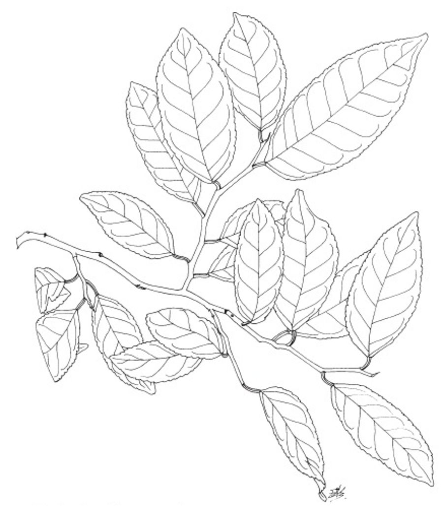
| Streblus banksii. Illustration: Eleanor Burton. |
Just above the cabbage tree we entered the forest. On the left we saw a large-leaved milk tree, Streblus banksii, planted about ten years ago. We were in a wide gully, known as ‘Slump Gully’, covered with loose boulders. The lack of understorey indicates that erosion is continuing. The size of the trees, which are mostly kohekohe, with occasional karaka, suggests that a large slump occurred here perhaps 200 years ago. Karaka seedlings grow profusely under karaka trees. They are pulled out regularly. We climbed out of the gully on its south side into an area of profuse groundcover and understorey growth. On the sides of the gully there are more mixed broadleaf trees and the canopy is lower. Tree species include mahoe, akiraho, ngaio, pigeonwood, mapou and titoki. The climbing ferns
Arthropteris tenella and
Blechnum filiforme were common, both ferns creeping over rocks to form mats.
We climbed slowly to a shelf where we were delighted to find, near our lunch spot, a young matai, the first to be discovered in this forest. Then we climbed to the forest margin, and across rank grass pasture saw the large gully to the south which is clothed in wind-sculptured
Coprosma propinqua, and areas of native bush with kanuka and whararaki.
Our return trip was straight down ‘Slump Gully’ which is quite steep at the top. We saw spectacular examples of puka,
Griselinia lucida, which started growth as an epiphyte, then sent roots to the ground. The upper trunk was much thicker than the roots. Also we noted several examples of akiraho,
Olearia paniculata, which had very thick trunks.
At the top of the zig-zag track we turned right and walked along Nga Uruora’s track past areas where ngaio, taupata, five-finger and karamu have been planted to fill grassy areas. These trees are irrigated from a tank high on the hill fed from the stream in upper ‘Slump Gully’. We passed through another patch of high kohekohe forest, and reached the terraces. These were built by Kiwirail about 1990 to stabilise the hillside because there was evidence of downward creep in the tunnel below. From the terrace we saw more NgaUruora plantings to the north. These terraces are covered in tree lucerne,
Chamaecytisus palmensis, which was sown about 2001 to provide shelter for natives to grow.
Note: also see Paekakariki–Pukerua Escarpment article below.
Participants : Sam Buckley, Paul Callister, Annie Chapman, Joe Clarkson, Barbara Clark, Rosemary Collier, Rae Collins, Gavin Dench, Ken Fraser (leader / scribe), Chris Hopkins, Chris Horne, Pat McLean, Barbara Mitcalfe, Chris Moore, Lynne Pomare, Sunita Singh, Julia Stace.
Paekakariki – Pukerua Escarpment
The steep land above SH1 and the North Island Main Trunk railway is owned by Kiwirail Ltd. In 1999 the railway land was covenanted to Queen Elizabeth II Trust (QEII), and in 2000 NgaUruora Kapiti Project (NUKP) signed a Management Agreement with QEII. The agreement gives NUKP the responsibility to protect and enhance the open space natural values. This includes managing all the threats to indigenous vegetation and wildlife from invasive weeds, rabbits, possums, rodents and other exotic animals. Our objective is to restore native vegetation to a mixture of kohekohe forest and wind-shorn scrub. We hope this will attract birds and help to provide “eco-corridors” from the coast to the inland forests, and along the coast, by linking the existing isolated patches of native bush.
NUKP was founded in 1997 when work on the escarpment began. We run three nurseries attached to schools in Pukerua Bay, Paekakariki and Raumati South where we grow native trees from locally-sourced seed. Over 10,000 trees are grown each year. We have planted native trees below the ‘Ecoforest’ (see trip report in this newsletter), on the terraces and further north on the escarpment. In summer there is little water here, so we have built an irrigation scheme to help the seedlings become established. We also have a big planting programme at the northern end of the escarpment below Paekakariki Hill Road. Access along the escarpment is not easy, so building tracks is part of our work. We hand-built a zig-zag track from the road to the 100-m contour (Bob’s Track) and a track – known as the Ho Chi Minh – running south from Paekakariki Overbridge.
NUKP relies on a mixture of volunteers and paid staff. For five years we have had a full-time Field Officer and several part-time paid workers. We run a contracting business which does weed control and planting work for local councils. The profi ts provide us with a small independent income to spend on our own restoration objectives. Otherwise we must raise funds from various funding organisations. Over the years we have been funded by Lotteries, Sustainable Management Fund, DOC, Greenfl eet, GWRC, KCDC, Pacific Development and Conservation Trust, and Community Conservation Trust.
We have a policy of removing invasive weeds as far as possible. English, German and Cape ivys are a big challenge. Periwinkle is also very persistent near the railway. Among the native weeds, we remove all karo trees and seedlings, and in the ‘Ecoforest’ we remove karaka seedlings. The escarpment was farmed until the early 1990s, so exotic rank grasses still cover most of the steep areas. It is interesting to note that these grasses are gradually being over-topped by
Muehlenbeckia complexa and native bush in many places. We are relying on natural regeneration to provide bush cover over the vast expanse of the escarpment in the long run. We have a monitoring programme with a series of photopoints to record long-term changes in the vegetation. Maps, and information on weeds, planting, volunteering and workbees, are on our website,
www.kapitibush.org.nz.
There are plans to build a walkway along the escarpment as part of Te Araroa (Cape Reinga to Bluff). This will make the escarpment much more accessible and we hope that people from Wellington and elsewhere will become more aware and supportive of our work.
Ken Fraser
 |
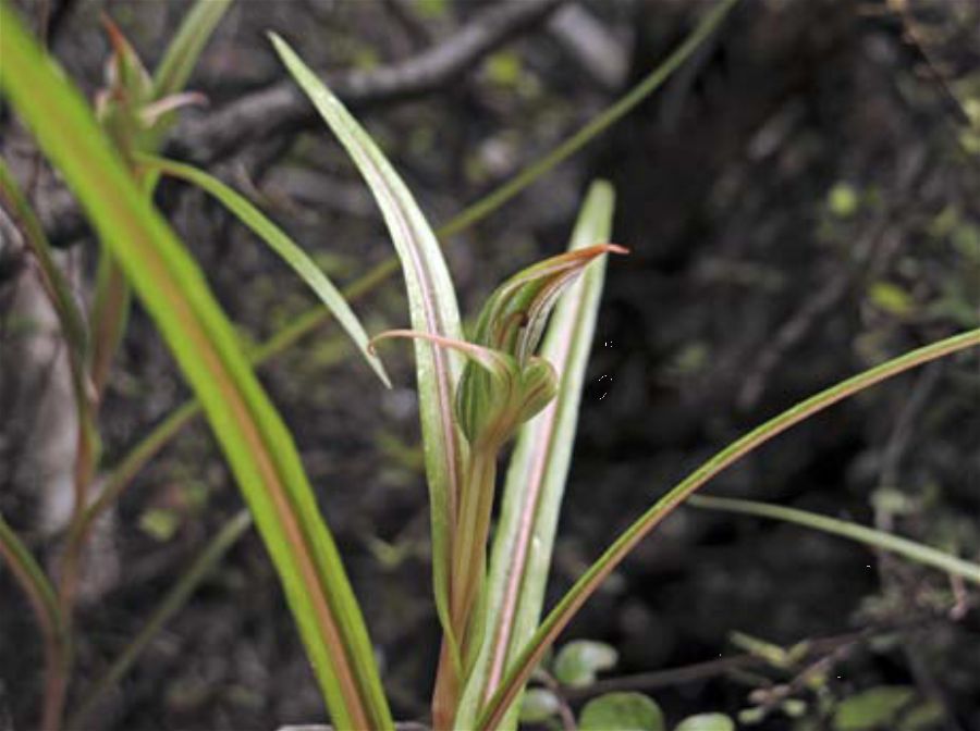
| Pterostylis irsoniana. Photo: Sunita Singh. |

 Site Index


 Site Index


